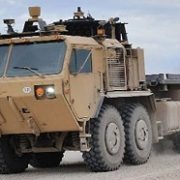
 In Part One of our series on GPS, we discussed its uses, problems, and alternatives. In Part Two, we take a look at the role of GPS in Unmanned Ground Vehicles (UGV).
Inertial Navigation System
Unmanned Aerial Vehicles (UAV) and ground vehicles often use a combination of GPS and Inertial Navigation System (INS). INS depends on input from motion sensors (accelerometers) and rotation sensors (gyroscopes). Through a process known as “dead reckoning,” the vehicle’s current position is calculated utilizing time passed from previous locations and estimates of speed.
INS has an ancient history. It is believed that the Chinese south-pointing chariot (a kind of compass) used a form of INS. Documented as early as 200–265 CE, it has been suggested that differential gears enabled the movable pointer on the chariot to always face south.
INS is subject to a kind of error, known as “drift.” Typically, GPS is used to correct the drift. GPS/INS determines current position and provides direction toward target location.
No GPS is an island
GPS interacts with a number of systems other than INS. Perception, in the form of onboard sensors, informs the UGV about its immediate surroundings, which is a task that GPS is ill-suited to do. While GPS satellites are often necessary to provide coordinates for the UGV’s absolute position, the location of the UGV relative to other members of a network can be calculated through the network’s communication signals. One of the biggest challenges facing UGV navigation is integrating the data inputs from the wide variety of systems.
I suspect that the interactivity of these various systems is one reason why there are such divergent claims about GPS’s accuracy for UGVs. I’ve seen reports that errors of 3 to 5 meters are common (horizontal location, which is usually more precise than vertical), while others state that precision is a matter of centimeters or less. GPS rarely acts alone, and its accuracy is reinforced by other modalities.
SAASM, what SAASM?
Of course, there are some systems you don’t want GPS to interact with. Counter IED(C-IED) jammers can affect GPS as well as the enemy’s ability to trigger roadside bombs. Also, we’re attacking the bad guys’ GPS, so a major requirement for Department of Defense’s GPS acquisition is compatibility to Blue Force Electronic Attack.
Much has been made of the military’s use of Selective Availability Anti-Spoofing Modules (SAASM). Its basic purpose is to prevent the enemy from using false signals to mislead the unmanned system’s GPS (i.e., spoofing). Essentially, the SAASM tells the unmanned system to ignore all GPS signals except the approved, restricted Military code (M-code). Another method for verifying the validity of individual satellite signals is Receiver Autonomous Integrity Monitoring (RAIM).
Currently, SAASM is effective for anti-spoofing, but not anti-jamming. There are plans to use ground-based high gain, directional antennas to augment the satellite broadcast of M-code in a specific Area of Responsibility (AOR). This strengthen M-code would then have anti-jamming capabilities.
The use of SAASM is well-known for UAVs, but I have had trouble determining its utilization on UGVs. At the recent AUVSI North America 2012 conference, I asked a range of experts about this and got divergent answers:
. “Every UGV in theater has a SAASM. I guarantee it.”
. “No UGV uses SAASM. Period.”
. “80% of all UGVs use SAASM.”
. “Oh, I say at least 80% of all UGVs have no SAASM.”
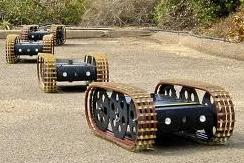
Bear in mind, I only asked people who were in some way expert, or were in a position to know from direct personal experience. One reason these responses may have been so contradictory is the variable definition of UGV. Consider throwbots, such as those made by ReconRobotics. Widely deployed and utilized, as well as a valuable asset for our soldiers in the fray, they are often overlooked when discussing UGVs. It is unlikely the diminutive throwbots have SAASM.
The human factor
However, I suspect these disparate answers reflect a truth about UGVs and GPS; GPS is not currently as critical for UGVs as it is for UAVs. I am sure that if I asked about operating range or power requirements, I would have received more consistent answers. Since, most UGVs are remotely navigated by a human operator, GPS is simply not topmost in the minds of the UGV community.
A typical current mission may involve a UGV searching an urban environment, such as buildings and tunnels. These urban areas typically deny GPS service. The UGV is often within Line Of Sight (LOS) of the human operator, so sophisticated navigational capabilities as well as autonomy are not as significant. This kind of teleoperation has a limited range. One kilometer is often cited as a standard for LOS operation, but an experienced UGV pilot told me that 300 feet is more realistic.
Human Machine Interface (HMI) characteristics can be a factor as much as GPS/INS and other subsystem issues. While GPS reception may be adversely impacted while a UGV is operating in a dense, cluttered area, this kind of chaotic environment also presents a challenge to the human operator. Usually, the human operator is using a two-dimensional interface to navigate a UGV in a three-dimensional environment. Studies have shown that the lack of depth perception may impact performance (see War and depth: Why your battlefield robot needs 3D).
You say navigation, I say autonomy
The GPS/INS combination will assume greater importance as the role of the human operator in navigation recedes. Since navigation is really a set of numerous subtasks, autonomous capabilities will have to meet a variety of challenges, including:
. Determining absolute location
. Establishing relative location (i.e., where is the UGV in relationship to others)
. Situational awareness (location of friendly and enemy forces)
. Internal mapping of surroundings
. Obstacle avoidance
. Path planning for waypoint and final destination
The relationship of autonomy and the human operator as well as the importance of each subtask will vary with each mission. In Technology
Development for Army Unmanned Ground Vehicles, the National Research Council, (Committee on Army UGV Technology) describes the navigational impact on a variety of applications.
For the “Donkey” application, the UGV is semi-autonomous, often following a specific path from Point A to Point B. For this application, “breadcrumbs” (i.e. radio frequency tags, GPS waypoints) could be placed on the path, and the human operator’s own navigational sense would be less utilized. Autonomous capabilities for obstacle avoidance, internal mapping, and path planning would assume greater significance.
In the “Wingman” application, no clear pathway is defined. I assume that this scenario describes a UGV that follows human warfighters as they patrol. The subtasks of determining absolute and relative position to the human leader are critical. GPS/INS would be the main navigation system. Of course, it would be augmented by sensors and the occasional human intervention.
Note that as the application demands greater UGV autonomy, GPS becomes more important. This isn’t an exact correlation; UGVs used for target practice need not be autonomous, but must have GPS for safety and verification reasons.
Antennas
“GPS antennas are big, fat, and ugly,” said one UGV developer at AUVSI North America. Like any other hardware component, GPS antennas take up real estate, which is not a problem for the larger UGVs, but can be for smaller ones. Antennas must be placed so they can receive the GPS signals. However, the position of the antenna may be complicated by the need for clearance with the effector arm.
Challenges
GPS is susceptible to jamming and spoofing, but they are not the most significant problems. A more important obstacle is denial of GPS service, especially in enclosed environments and dense cluttered areas.
No one navigation system is perfect or free of vulnerabilities, so multiple modes of navigation must be utilized. Integration of the GPS, INS, sensor data, HMI factors, communications, and autonomous capabilities may be the biggest single GPS-related challenge that UGVs face today.
One UGV operator described it this way, “It’s similar to the lost link problems of UAVs. Suppose I have a UGV going in and out of a building. The GPS will go in and out as well. We need the UGV to be able to transfer from one navigation system to another, as needs dictate. We’re not there yet.”
This obstacle will grow more significant as mission endurance, range, and autonomy of UGVs grow.