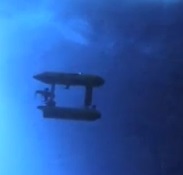
An Unmanned Underwater Vehicle (UUV) braved the hostile Antarctic seas to give us a view of the underside of sea ice. When combined with satellite and other data, this should produce the first 3-D map of Antarctic sea ice.
Read the scientific paper here and/or watch the Reuters video below. (Warning-short ad before the video)

